top of page

DESASTRE VERDE
cell group 3 11-Thatcher

GEOGRAPHY
To prepare for a disaster one should be aware of the local evacuation sites. Here is a sample simulation of an evacuation plan during an eruption.
FROM THE VILLAGE OF
MT. MIRIAM, LAGUNZADA, PHILIPPINES
evacuation map
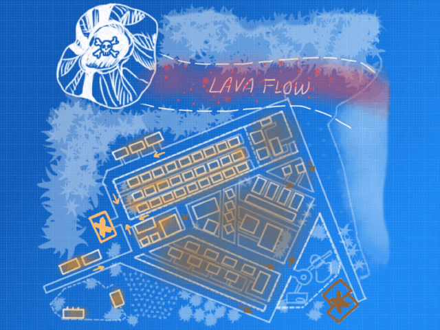
Here's an example of a blueprint for the evacuation map in GIF format.
The X-s marked are the evacuation centers and the arrows symbolizes the direction on how to go to the centers.

CONTACT US.
ADDRESS:
Katipunan Avenue, Loyola Heights
Quezon City 1108 Philippines
EMAIL ADDRESS:
TELEPHONE NUMBER:
731-840-385
MAILING ADDRESS:
U.P. P.O. Box 110, Diliman
Quezon City, Philippines 1101
TRUNKLINES:
(+63 2) 580-5400 to 29
(+63 2) 435-9240 to 46


bottom of page